Are You Ready For Snow?

Portland, Ore. — The National Weather Service has issued a special weather statement for much of western Oregon and Washington for next week.
...CHANCES INCREASING FOR LOWLAND SNOW NEXT WEEK...

A pair of strong cold fronts will move across the Pacific
Northwest through the weekend, and the pattern will turn
significantly colder next week. These cold fronts will likely
bring heavy snow to the Cascades. Snow levels are expected to
remain well above the valley floors through Sunday.

The colder air is expected to move into southwest Washington and
northwest Oregon early next week, potentially cold enough to bring
snow levels down to the valley floor. An increasing number of
forecast models are suggesting additional disturbances from the
Gulf of Alaska which would spread moisture into that colder air.
This will raise the chance for snow down to the lowest elevations
next week.

While accumulations, distribution, and/or timing of snow remain
uncertain, confidence is increasing in the overall threat of snow
next week, even for the lowest elevations. Now is a good time to
make sure you are prepared in the event that all of the necessary
ingredients come together for a significant snow event next week.


KGW Meteorologist Rod Hill is also watching the system closely.
Today we’re looking at the very latest runs of the European and the GFS (Global Forecast System) models. Today’s take: The GFS remains consistently cold when compared to its last few runs. If anything, the GFS has trended a little colder.
The European model is not as cold as the GFS, but what’s new today is that the Euro has trended colder than its previous runs.
As a forecaster, it helps to see some consensus, so this increases our confidence we’re in store for a cold snap next week. That in and of itself will be a bit of a shock for us. Portland International Airport has not officially dropped to freezing since Dec. 26. It’s possible we’re looking at at least a day or two next week where the high temperatures don’t reach freezing.
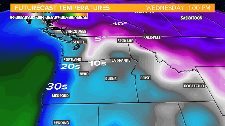
As for snow, we think there will be some wet snowflakes mixed in with rain showers Sunday night and Monday as the colder air arrives behind a departing storm system.
Beyond, there’s too much variability in the models to lock in on any one particular weather system that might bring the area snow. Those variables include the timing and placement of any storm centers, along with their ultimate track. But we’re especially watching midweek right now.
We’ll update this with increasing frequency and more detail as those specifics become more clear.
RELATED: Be prepared when severe weather hits! Download the KGW app
RELATED: The stage is set for a possible snow event in Portland next week


